Esk Dale is the largest dale within the North York Moors, and the only one of the major valleys that flows directly into the sea, reaching the North Sea at Whitby. Esk Dale is something of a cross-section of the Moors, starting in wild heather moorland, passing through increasingly gentle scenery and reaching the sea at the most attractive of the area's towns.
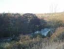
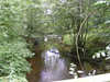 The River Esk rises at the southern tip of Westerdale, in the area of Esklets Crag. Esk Dale itself begins where Westerdale merges with Baysdale, just to the west of Castleton. The valley then runs east through the moors towards Whitby, passing a whole series of side dales. First is the valley of Commondale Beck, which flows in from the north-west. At Castleton Danby Dale is the first of a whole series that flow in from the south - Danby Dale, Little Fryup Dale, Great Fryup Dale and Glaisdale. A series of further valleys flow into the Esk lower down, but don’t gain the name of dale. The two sides of the valley are thus somewhat different in character. The northern side is bordered by a fairly continuous stretch of high ground, running west to east parallel with the river. The southern side is dominated by a series of ridges that run north to south into the valley - Castleton Rigg, Danby Rigg and Glaisdale Rigg being the most prominent.
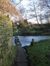
Esk Dale differs from the other Moorland dales in a number of ways. The two most obvious are size and direction, with most of the rest flowing north or south. Another notable difference is the number of communities to be found in the dale. We start with Castleton, on a ridge south of the river. Next are Ainthorpe and Danby, on opposite sides of the river. Next is the hamlet of Houlsyke, running along the road north of the river. Lealholm is the first genuinely river-side village. Glaisdale sits just to the south of the river, above a steep tree-lined slope. Egton Bridge runs along both sides of the Esk, linked by that bridge. The more industrial village of Grosmont is just south of the river, where the North York Moors railway joins the mainline. As we approach Whitby we pass Briggswath and Sleights, sitting on opposite sides of the river, at the start of a small pocket of land outside the National Park. The last village is Ruswarp, just outside Whitby. The river then turns north and flows through that attractive seaside town to reach the North Sea. Those approaching Esk Dale along the road from Kildale and Stokesley might expect to find Commondale in this list, but that village is actually in one of the side valleys and not the main dale itself.
 When the glaciers that once covered the area began to melt a massive lake formed in what is now Esk Dale. As this lake drained the water carved out some of the area's most dramatic valleys, including Newton Dale, which now carries the North York Moors Railway, and further east the Forge Valley. The water couldn't escape east as the sea was covered with ice for longer than much of the land.
Esk Dale has kept its railway, and this offers a very convenient way to see the entire valley. The railway enters the Moors at Kildale, runs past Commondale into Esk Dale and follows the valley all the way to Whitby.
Grid Reference: NZ 673 076 to NZ 899 115
NZ7108/01: Little and Great Fryup Dales - starts and finishes in Esk Dale
NZ7805/01: The Glaisdale Round - starts and finishes in Esk Dale
NZ 6807/01 Westerdale and the Esk - starts and finishes in Esk Dale