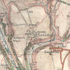
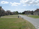
 Levisham is an elegent village set around a long wide village green, with the Horseshoe Inn at the top end of the green. The village lies at the southern end of a plateau that eventually leads to Levisham Moor, overlooking the Hole of Horcum and Newton Dale.
 This is a good alternative approach to the Hole of Horcum, avoiding the crowds to be found on the main road. Levisham Moor itself is often used by handglider enthusiasts.
The original parish church of Levisham was St. Mary's, down at the bottom of the valley south of the village. It fell out of use during the 1950s in favour of the former chapel of ease dedicated to St. John the Baptist, at the northern end of the village.
Although the public road west stops at Levisham Station, it is possible to continue along the private forest road by paying a toll.
 Levisham is on Ordnance Survey Explorer Map OL27 (North Yorks Moors Eastern Area)
Get it from ![]()